I try not too! 6's are the norm where I live (hour north of Long Beach). Large craft (gail warning) goes up here quite frequently.
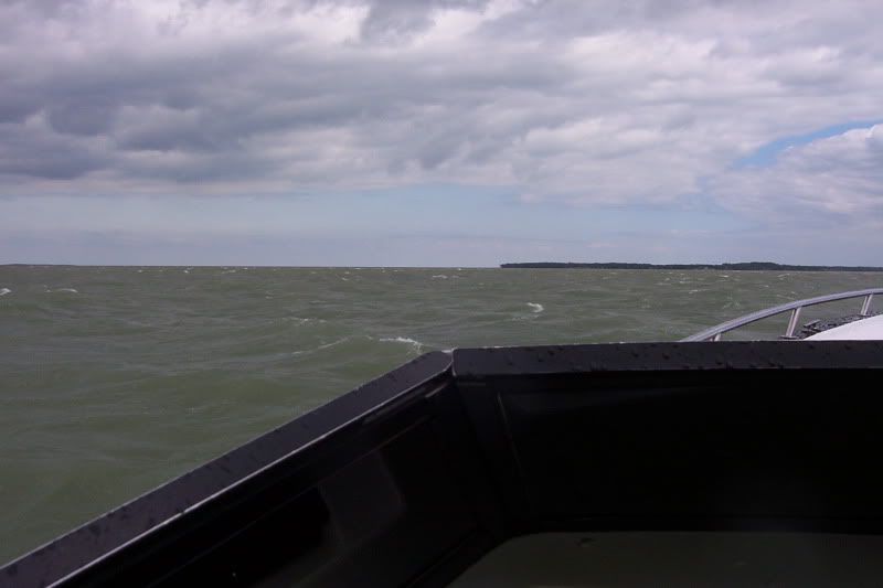
There were taken last year. 10-14' swell that day per NOAA!! I sh!t you not. They were spaced out and there was no wind so you didn't get the washing machine effect. Couldn't see anything but water all around you when you were down in between them. Scared the crap out of my passengers!:sifone:
This is from December 2007 off the Oregon Coast
Building-sized Waves, Stunning Winds, Big Rains
Posted by The Oregonian December 03, 2007 18:48PM
Categories: Storm Coverage
...PACIFIC BUOYS...
BUOY 50 (OFF NEWPORT).................. 76 MPH (SUSTAINED 50 MPH)
AVERAGE SEAS.... 40 FEET HIGHEST WAVE... 60-70 FEET
BUOY 89 (50 MI W OF TILLAMOOK)......... 67 MPH (SUSTAINED 50 MPH)
AVERAGE SEAS.... 42 FEET HIGHEST WAVE... 60-70 FEET
BUOY 29 (COLUMBIA RIVER BAR)........... 67 MPH (SUSTAINED 45-50 MPH)
AVERAGE SEAS.... 44 FEET HIGHEST WAVE... 60-70 FEET
...WASHINGTON COAST...
CAPE DISAPPOINTMENT................... 104 MPH
TOKE POINT (NORTH END OF WILLAPA BAY).. 75 MPH
BAY CENTER............................. 72 MPH
OYSTERVILLE............................ 67 MPH
OCEAN PARK............................. 67 MPH
LONG BEACH............................. 60 MPH
...NORTH OREGON COAST...
BAY CITY (NEAR TILLAMOOK).............. 129 MPH
CAPE MEARES (TYPICALLY HIGH BIAS)...... 114 MPH BEFORE POWER LOSS
TILLAMOOK BAY TIDE GAGE................ 100 MPH
ROCKAWAY BEACH......................... 87 MPH
ASTORIA (WEST SLOPE)................... 86 MPH (SUSTAINED 45-50 MPH)
CLATSOP SPIT........................... 85 MPH (SUSTAINED 70 MPH)
ASTORIA AIRPORT........................ 85 MPH
GARIBALDI.............................. 81 MPH (LOST POWER 5 PM SUN)
YOUNGS BAY............................. 80 MPH
CANNON BEACH........................... 80 MPH
TILLAMOOK (DOWNTOWN)................... 75 MPH
TILLAMOOK AIRPORT...................... 74 MPH